EN
EN  PT_BR
PT_BR An analysis of the spatial concentration of Brazilian agricultural production reveals a profound reconfiguration of the national production map since the 2000s. The study is available on the data platform. SITE-MLogResearch from Embrapa Territorial (SP) shows that, as the main export chains advanced, new regions emerged and gained prominence, while others lost relevance.
Soybeans are the most emblematic example of this transformation. The crop has grown and expanded throughout the national territory, reducing its geographic concentration. In 2000, four microregions accounted for a quarter of national production — Parecis (MT), Alto Teles Pires (MT), Barreiras (BA), and Southwest Goiás (GO). In 2023, this share was shared with Canarana (MT) and Dourados (MS). “Soybeans continue to expand as the first-choice crop for summer harvests in various regions of Brazil,” says André Farias, an analyst at Embrapa Territorial, highlighting: “In addition to showing moderate growth in traditional regions, the crop has also spread significantly in the Matopiba region, in northern Mato Grosso, in the state of Pará, and in the southern half of Rio Grande do Sul. In this case, therefore, the decrease in concentration is driven by the opening of new fronts for the expansion of the crop in the territory.”

According to the analyst, much of this expansion occurred over degraded pasture areas, which reinforces the role of soy as a driver of more efficient land use without necessarily encroaching on new areas of native vegetation.
While soybean production spread, corn production followed the opposite path. Production also grew significantly, but became more concentrated in already consolidated regions. In 2000, 13 microregions, distributed across seven states, accounted for 251 TP4T of the national harvest. In 2023, even with the jump from 8 to 34.9 million tons, this percentage became concentrated in only four microregions—all in the Central-West region: Alto Teles Pires (MT), Sinop (MT), Southwest Goiás (GO), and Dourados (MS). Of these, only Sinop was not part of the group in 2000. “The changes in spatial concentration observed in corn are closely linked to the strengthening of the crop as a second-crop alternative in soybean production systems, especially in Mato Grosso,” explains Farias.

He emphasizes that second-crop corn has become a viable and highly attractive economic alternative for producers and companies in the region, enabling substantial increases in production volumes over the last 15 years. “Although second-crop corn is produced in several other areas of the country, its cultivation is more demanding in terms of climatic conditions, especially rainfall and temperature—meaning that not all regions have the conditions conducive to the crop's economic yield. This favors the concentration observed in the data presented on the platform,” he points out.

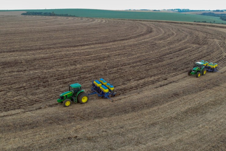
Photo: Disclosure/OPR Archive
According to Gustavo Spadotti, head of Embrapa Territorial, the consolidation of this dynamic was only possible due to the technological improvement of cultivars and management adjusted to the agricultural calendar. "The fine-tuning of the planting calendar, provided by earlier-maturing soybean and corn cultivars, creates suitable conditions for cultivating two subsequent crops," he emphasizes.
Spadotti further emphasizes that Strategic Territorial Intelligence (STI) plays an essential role in understanding and planning this new scenario for Brazilian agribusiness. "The concepts of Strategic Territorial Intelligence seek precisely to anticipate these scenarios and provide the private sector and public policy makers with the necessary inputs to enable the productive and sustainable development of Brazilian agriculture," he explains.
With the two main agricultural commodities following different paths – soybeans spreading and corn becoming more concentrated – the current picture of Brazilian production reinforces a central point: the capacity for regional adaptation and the intensive use of technology continue to be the driving forces that sustain Brazil's leading role in the global agricultural landscape.
About SITE-MLog
The Strategic Territorial Intelligence System for Agricultural Macrologistics (SITE-MLog) is an interactive platform developed by Embrapa Territorial that organizes data on the production, export, and logistics infrastructure of ten Brazilian agribusiness production chains: cotton, cattle, coffee, sugarcane, poultry, oranges, wood for paper and pulp, corn, soybeans, and swine. Free and accessible through the Embrapa Portal, the system allows the generation of maps and graphs from official information, supporting rapid analyses and more efficient strategies for the public and private sectors.
Launched in 2018 and updated in 2024, SITE-MLog provides dynamic dashboards on the spatial concentration of agricultural production, export flows by region, and the ports used, as well as the location of warehouses and processing units such as meatpacking plants and sugar-energy mills. The tool introduced the concept of logistics basins, which reveals which port each exporting Brazilian microregion uses to ship grains (soybeans and corn) to the international market. In the new version, it now estimates, for the first time, the supply and demand of agricultural nutrients, based on regional production and scientific indicators.
More than just gathering scattered data, SITE-MLog transforms raw records into easily understandable geospatial information. The system is used by public managers, researchers, and investors to support the planning of infrastructure projects, public policies, and strategic decisions in the field.