![]()
The Cosmo model of the National Institute of Meteorology (Inmet) shows rainfall with accumulations of around 50 millimeters in 24 hours for various points in the states of Mato Grosso do Sul and Paraná. The forecast is that these rains will occur between Thursday (24) and Friday (25).
According to information from Inmet, this condition is caused by the presence of a low pressure area in the upper levels of the atmosphere, combined with the availability of heat and high humidity in the region.
“Due to this meteorological system, areas of these two states, such as the Pantanal and several municipalities in Paraná, such as Cascavel and Cianorte, may receive rainfall volumes between 50 mm and 100 mm in 24 hours, accompanied by gusts of wind with speeds of up to 100 km/h”, published the Institute.
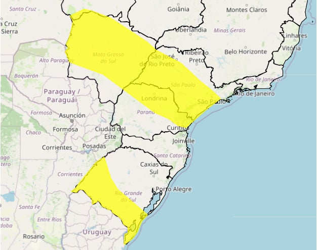
On Wednesday (23), Inmet issued an orange alert, of danger, valid between 3 am on the 24th and 25th, for heavy rains between the west and south of Mato Grosso do Sul to the west of Paraná. The affected areas are: Western Center of Paraná, Northwest of Paraná, Southwest of Mato Grosso do Sul, West of Paraná, Pantanais South of Mato Grosso, North Central of Paraná, East of Mato Grosso do Sul, South Central of Paraná, Presidente Prudente, North Center of Mato Grosso do Sul.

In these locations, rainfall of between 30 and 60 mm/h or 50 and 100 mm/day and strong winds (60-100 km/h) may occur. There is a risk of power outages, falling tree branches, flooding and electrical discharges.
According to the Institute, as this system moves eastwards, rain could hit areas of São Paulo from Friday (25). The Cosmo model shows accumulated precipitation of around 70 millimeters in 24 hours over the central part of the state of São Paulo, reaching even slightly less intensely in the south of Minas Gerais.